
|
|
|
|
CONTACT
FLOOD HISTORY
PHOTO GALLERY
SYSTEM COMPONENTS :
FORECASTS:
PROJECT
SYSTEM COMPONENTS
OPERATIONS
FORECASTS
|
EARTHEN LEVEE
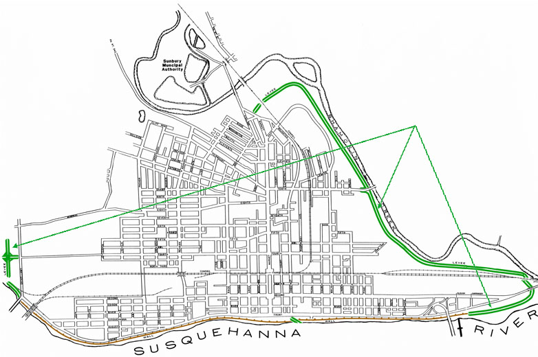
Sunbury's levees span a distance of approximately 2.6 miles and are divided in 3 sections
• Shamokin Creek section - 9,940 feet
• Upper Susquehanna River section - 1,800 feet
• Lower Susquehanna River section - 2,000 feet

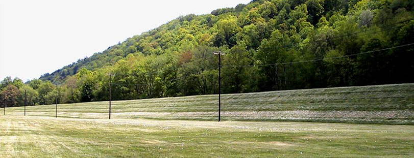
Levees have a crown width of 8 feet and side slopes of 2.5 feet horizontal to 1 foot vertical. Average height varies between 16 and 18 feet.
EARTHEN LEVEE
UPPER SUSQUEHANNA SECTION
LOWER SUSQUEHANNA SECTION
The Shamokin Creek section commences at high ground at Market Street and follows Shamokin Creek to the confluence with the Susquehanna River. Openings have been provided for Closure Structures at Market Street, North Shore Railroad, Tenth Street and the Norfolk Southern railroad.
The Lower Susquehanna section continues the level of protection from the Shamokin Creek section to where it ties-in with the concrete floodwall in the vicinity of Garringer Alley.
The Upper Susquehanna River section begins at the flood wall tie-in near the Thomas Edison Bridge and terminates at high ground at Mt. Pleasant Road. An opening has been provided in this section for the Canadian Pacific Railroad.
Prior to placing the earthen embankment, the entire area under the levee was stripped to a minimum depth of 6 inches, inspection trenches were excavated to determine foundation conditions and, when considered necessary, unsuitable material in the foundation was removed and replaced with impervious fill. In the event that seepage occurs under the levee it will be intercepted by seepage pipes and are diverted to the storm conveyance system.
Flood Operations Center
826 Hillside Road
Sunbury, Pennsylvania 17801
All contents © 2015 Sunbury Municipal Authority | site design: BLH Media